Welcome to etutorguru.in. The Resources and Development Class 10 Geography Chapter 1 is an important topic for CBSE exam preparation. To aid in their studies, students can use CBSE Notes, Mind Maps, and NCERT Solutions. CBSE Notes provide concise summaries of the chapter, while Mind Maps provide visual representations of the topics covered. NCERT Solutions offer detailed explanations and additional practice problems. Using these resources can help students perform better in exams.
Table of Contents –
You will get to know about the following topics in this article :
- What is a Resource
- Types of Resources
- Animated Video
- Development of Resources
- Rio de Janeiro Earth Summit
- Agenda 21
- Resource Planning
- Land Resources
- Conservation of Resources
- Land Utilisation
- Land use Pattern in India
- Land Degradation and Conservation of Resources
- Soil as Reosurce
- Download PDF Notes
- Download MindMap
What is a Resource ?
A resource is anything in the environment that can be used to meet our needs, provided it is technologically accessible, economically feasible, and culturally acceptable. The transformation of the environment involves an interactive relationship between nature, technology, and institutions. Human beings use technology to interact with nature and create institutions that accelerate economic development.
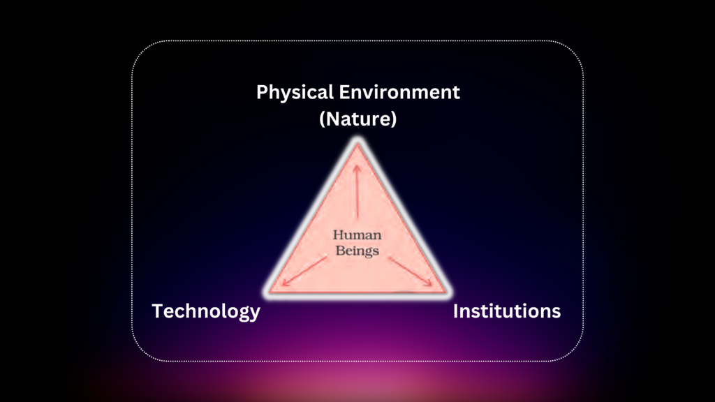
Resources are not free gifts of nature, but rather a function of human activities. Human beings are essential components in transforming materials available in the environment into resources. Resources can be classified into different types based on their origin and usage.
- On the basis of origin – biotic and abiotic
- On the basis of exhaustibility – renewable and non-renewable
- On the basis of ownership – individual, community, national and international
- On the basis of status of development –potential, developed stock and reserves.
TYPES OF RESOURCES
On the Basis of Origin
Biotic Resources:
The things referred to are living organisms, including humans, flora, fauna, fisheries, and livestock, that are obtained from the biosphere.
Abiotic Resources:
Abiotic resources are composed of non-living things, such as rocks and metals.
On the Basis of Exhaustibility
Renewable Resources:
Renewable resources are those that can be replenished through physical, chemical or mechanical processes. Examples include solar and wind energy, water, forests, and wildlife. Renewable resources can be divided into two categories: continuous or flow.
Non-Renewable Resources:
Minerals and fossil fuels are examples of resources that form over a very long geological time.
Some resources take millions of years to form, and while some, like metals, are recyclable, others, like fossil fuels, cannot be recycled and get exhausted with use.
On the Basis of Ownership
Individual Resources:
Individuals own various resources such as privately owned businesses, land allotted by the government, plots, houses, plantation, pasture lands, ponds, water in wells, etc. It is common for farmers to own land, while urban residents often own property. In some cases, people may be landless.
Community Owned Resources:
There are communal resources available to all members of a community, including village commons, public parks, picnic spots, playgrounds, and other accessible areas. These resources may include grazing grounds, burial grounds, village ponds, and more, and are typically available to all individuals living in the surrounding area, regardless of socioeconomic status.
National Resources:
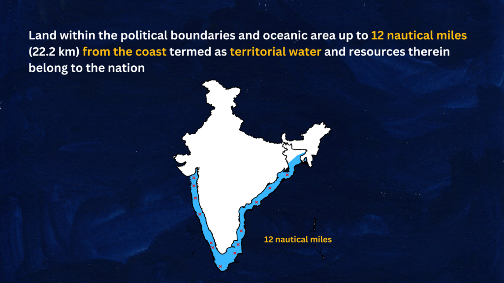
All resources within a nation’s political boundaries, including private property, belong to the nation and can be legally acquired for public good. This includes land, minerals, water resources, forests, wildlife, and oceanic area up to 12 nautical miles from the coast.
Urban Development Authorities are empowered by the government to acquire land for public projects such as roads, canals, and railways.
International Resources:
International institutions regulate some resources, including oceanic resources beyond a country’s 200 nautical miles coastline.
No individual country can utilize these resources without the concurrence of international institutions.
On the Basis of the Status of Development
Potential Resources:
The resources that are available in a particular region and can be utilised in the future. The western parts of India, such as Rajasthan and Gujarat, have untapped potential for wind and solar energy development despite having abundant resources in the region.
Developed Resources:
The development and utilization of resources depend on their quality, quantity, technology, and feasibility. Prior to utilization, resources must be surveyed to determine their potential.
Stock:
Stock refers to materials in the environment that could fulfill human needs, such as hydrogen as a source of energy, but cannot be accessed due to a lack of appropriate technology.
Reserves are a subset of stock that can be used in the future with existing technical knowledge. River water, for example, can generate hydroelectric power but is currently being used to a limited extent. Water in dams and forests is a reserve that can be utilized in the future.
Animated Video for Resources and Development – In Hindi and English
DEVELOPMENT OF RESOURCES
Resources are critical to human survival and quality of life, but the belief that they are free gifts of nature has led to indiscriminate use and significant problems.
- The depletion of resources is caused by the greed of a few individuals.
- The accumulation of resources in few hands has led to the division of society into two segments, namely the haves and the have nots, or the rich and the poor.
- The exploitation of resources has had devastating consequences on the environment, leading to global ecological crises such as global warming, ozone layer depletion, environmental pollution, and land degradation.
Equitable distribution of resources is necessary for global peace and sustained quality of life. Resource planning is crucial for the sustainable existence of all forms of life and is a component of sustainable development.
Failure to address resource depletion by a few individuals and countries could endanger the future of the planet.
Sustainable development
Sustainable economic development means preserving the environment while ensuring that the needs of the present generation are met without compromising the needs of future generations
Rio de Janeiro Earth Summit, 1992

In 1992, over 100 heads of state gathered in Rio de Janeiro for the International Earth Summit.
- The summit was convened to address urgent problems of environmental protection and socioeconomic development at a global level.
- The summit resulted in the signing of the Declaration on Global Climatic Change and Biological Diversity, the endorsement of the global Forest Principles, and the adoption of Agenda 21 for achieving Sustainable Development in the 21st century.
Agenda 21

Agenda 21 is a declaration signed by world leaders at the 1992 United Nations Conference on Environment and Development in Rio de Janeiro, Brazil.
- Its goal is to achieve global sustainable development by addressing environmental damage, poverty, and disease through global cooperation.
- One of its major objectives is for every local government to create its own local Agenda 21.
RESOURCE PLANNING
- Balanced resource planning is essential in India due to the diverse availability of resources across the country.
- Some regions are rich in certain types of resources while deficient in others, making planning crucial.
- For example, while some states are rich in minerals and coal deposits, others lack in infrastructural development or water resources.
- National, state, regional, and local level resource planning is necessary to ensure judicious use of resources.
Resource Planning in India
Resource planning is a complex process which involves :
- Resource identification and inventory involves surveying, mapping, and estimating the qualitative and quantitative measurement of resources across the different regions of the country.
- Matching resource development plans with national development plans is important for overall development.
- The resource development plans require a suitable planning structure with the necessary technology, skills, and institutional setup to be established for their successful implementation.
India has made significant efforts towards achieving resource planning goals since its first Five Year Plan after Independence.
- The availability of resources alone is not enough for development as technology and institutions play a crucial role.
- Some resource-rich regions may still be economically backward while some resourcepoor regions may be economically developed.
Conservation of Resources
Resource conservation is important to avoid socio-economic and environmental problems caused by irrational consumption and over-utilization of resources. The conservation of resources has been a main concern of past leaders and thinkers.
Gandhiji believed in conserving resources and coined the phrase, “There is enough for everybody’s need and not for anybody’s greed.” He believed that greedy and selfish individuals and exploitative modern technology were the root causes of resource depletion. Gandhiji advocated for production by the masses,opposing mass production.
Key contributions to the advocacy of resource conservation at the international levelinclude the Club of Rome’s 1968 call for conservation, Schumacher’s 1974 book Small is Beautiful, the Brundtland Commission’s 1987 report introducing the concept of Sustainable Development, and the 1992 Earth Summit in Rio de Janeiro.
LAND RESOURCES
Land is a crucial and finite natural resource that supports various economic activities, wild life, human life, transport, and communication systems. Its importance warrants careful planning for the allocation and utilization of available land.
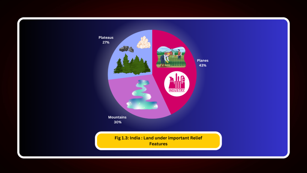
India’s land is comprised of mountains, plateaus, plains, and islands. 43% of the land area is plain which is good for agriculture and industry. Mountains account for 30% of the total surface area, ensuring perennial flow of some rivers, and provide facilities for tourism and ecological aspects.
About 27% of the area is the plateau region, which is rich in reserves of minerals, fossil fuels, and forests.
LAND UTILISATION
Land resources are used for the following purposes:
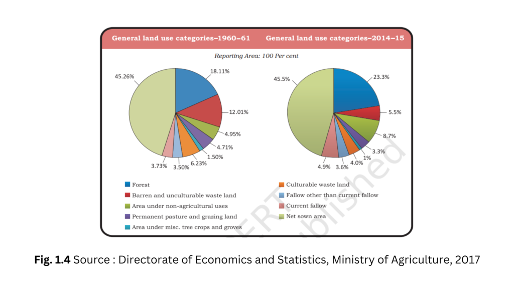
- Forests
- Land not available for cultivation
(a) Barren and waste land
(b) Land put to non-agricultural uses, e.g. buildings, roads, factories, etc. - Other uncultivated land (excluding fallow land)
(a) Permanent pastures and grazing land,
(b) Land under miscellaneous tree crops groves (not included in net sown area),
(c) Culturable waste land (left uncultivated for more than 5 agricultural years). - Fallow lands
(a) Current fallow-(left without cultivation for one or less than one agricultural year),
(b) Other than current fallow-(left uncultivated for the past 1 to 5 agricultural years). - Net sown area – It refers to the land on which crops are sown and harvested. The gross cropped area is the net sown area plus the area sown more than once in an
agricultural year.
LAND USE PATTERN IN INDIA
- The use of land is influenced by physical factors, including topography, climate, and soil types, as well as human factors such as population density, technological capability, and cultural traditions.
- Out of India’s total geographical area of 3.28 million sq km, land use data is only available for 93% of it due to incomplete land use reporting in most of the north-eastern states, except Assam. Additionally, some areas of Jammu and Kashmir occupied by Pakistan and China have not been surveyed for land use.
- The amount of permanent pasture land has decreased, which raises concerns about feeding the cattle population. Most available lands are of poor quality or have high cultivation costs, and are cultivated once every two to three years. Including these lands in the net sown area brings the percentage of NSA in India to about 54% of the total reporting area.
- Net sown area varies greatly among states in India, ranging from over 80% in Punjab and Haryana to less than 10% in Arunachal Pradesh, Mizoram, Manipur, and Andaman Nicobar Islands.
- The forest area in the country falls short of the desired 33% of geographical area outlined in the National Forest Policy (1952) for maintaining ecological balance. This impacts the livelihoods of millions of people who depend on forests for their living.
LAND DEGRADATION AND CONSERVATION MEASURES
- Human activities such as deforestation, overgrazing, mining, and quarrying have contributed significantly to land degradation. As 95% of our basic needs for food,
- shelter, and clothing are obtained from land, it is important to share our land with past and future generations.
- Mining can cause severe land degradation and environmental damage, leaving behind deep scars and traces of over-burdening. Deforestation, overgrazing, and over-irrigation are some of the main causes of land degradation in different states. Additionally, mineral processing generates a large amount of dust in the atmosphere, which has negative impacts on the environment. It retards the process of infiltration of water into the soil after it settles down on the land.
- Industrial effluents have become a significant source of land and water pollution in many parts of the country in recent years. Methods to solve land degradation include afforestation, proper grazing management, planting shelter belts, control on overgrazing, stabilization of sand dunes and waste land management. Additionally, control of mining activities and proper treatment and disposal of industrial effluents and waste can reduce degradation in industrial and suburban areas.
SOIL AS A RESOURCE
Soils in India are classified into different types based on factors such as soil formation, colour, thickness, texture, age, and chemical and physical properties.
Classification of Soils
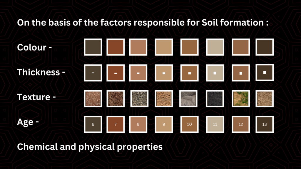
India’s diverse relief features, landforms, climatic realms, and vegetation types have led to the development of various types of soils.
Alluvial Soils
- The northern plains have alluvial soil that has been deposited by three important Himalayan river systems – the Indus, the Ganga, and the Brahmaputra. This soil is also present in Rajasthan and Gujarat through a narrow corridor.
- Alluvial soil is present in the deltas of several rivers, including the Mahanadi, Godavari,Krishna, and Kaveri, in the eastern coastal plains. This soil is composed of varying proportions of sand, silt, and clay.
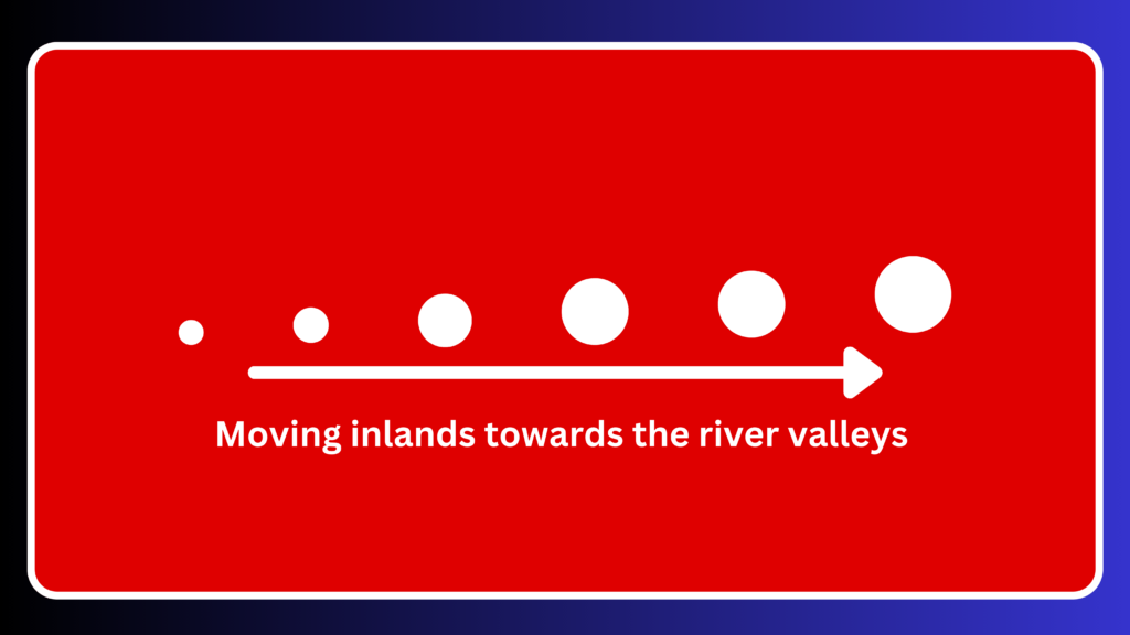
- Soil particles appear larger in size as we move inlands towards river valleys, with coarse soils more common in piedmont plains. Soils are also described based on their age.
- Alluvial soils can be classified into two types based on age: old alluvial (Bangar) and new alluvial (Khadar). Bangar soil has a higher concentration of kanker nodules and more fine particles than Khadar soil. However, Khadar soil is more fertile than Bangar soil.
- Alluvial soils are fertile and contain ideal levels of potash, phosphoric acid, and lime for the growth of various crops such as sugarcane, paddy, wheat, and other cereal and pulse crops. Alluvial soils are highly fertile and lead to intensive cultivation and dense populations.
- Drier areas have more alkaline soils that can be productive after proper treatment and irrigation.
Black Soil
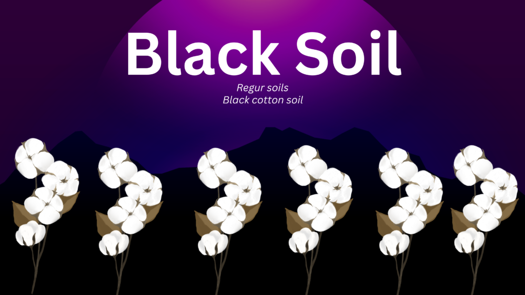
- Black soil, also known as regur soil, is ideal for growing cotton and is often referred to as black cotton soil.
- Black soil is formed due to climatic conditions and the parent rock material, particularly in the Deccan trap region of the northwest Deccan plateau. This type of soil is composed of lava flows.
- The black soils of India cover plateaus and valleys in several states, including Maharashtra, Saurashtra, Malwa, Madhya Pradesh, and Chhattisgarh.
- These soils are composed of extremely fine, clayey materialThese soils are rich in moisture-holding capacity and various soil nutrients like calcium carbonate, magnesium, potash, and lime but are generally deficient in phosphoric content.
- During hot weather, deep cracks develop in the soil which promotes proper aeration.
- Working with these soils is challenging due to their stickiness when wet, requiring immediate tilling after the first shower or during the pre-monsoon period.
Red and Yellow Soils
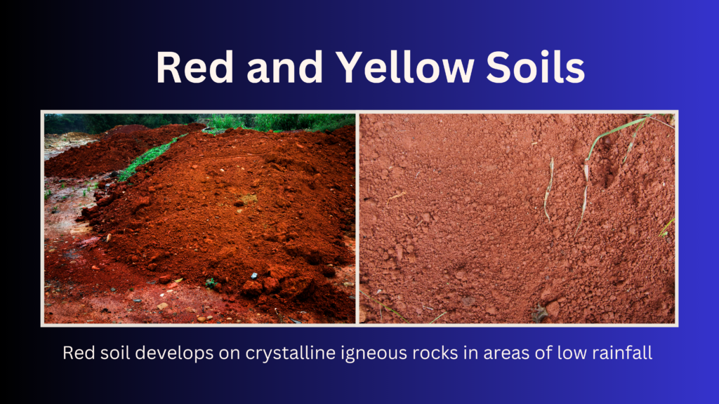
- Red and yellow soils are found in areas of low rainfall in the Deccan plateau, as well as in parts of Odisha, Chhattisgarh, the middle Ganga plain, and the piedmont zone of the Western Ghats.
- These soils derive their reddish color from the diffusion of iron in crystalline and metamorphic rocks. When hydrated, the soil appears yellow.
Laterite Soil

- Laterite soil is formed in tropical and subtropical regions with alternating wet and dry seasons. The term “laterite” comes from the Latin word “later,” meaning brick.
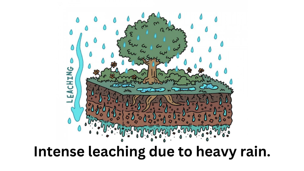
- Lateritic soils are deep and acidic, and occur mostly in southern states, Western Ghats region of Maharashtra, Odisha, some parts of West Bengal and North-east regions. They are deficient in plant nutrients due to intense leaching from heavy rain.
- Soil quality and humus richness vary based on the type of vegetation and environment. In areas with deciduous and evergreen forests, the soil tends to be humus rich, while in semi-arid environments with sparse vegetation, the soil is generally humus poor.
- Soil in hilly areas of Karnataka, Kerala and Tamil Nadu is prone to erosion and degradation due to their position on the landscape. However, after adopting appropriate soil conservation techniques, this soil can be useful for growing tea and coffee.
- Red laterite soils in Tamil Nadu, Andhra Pradesh, and Kerala are well-suited for cashew nut cultivation.
Arid Soils
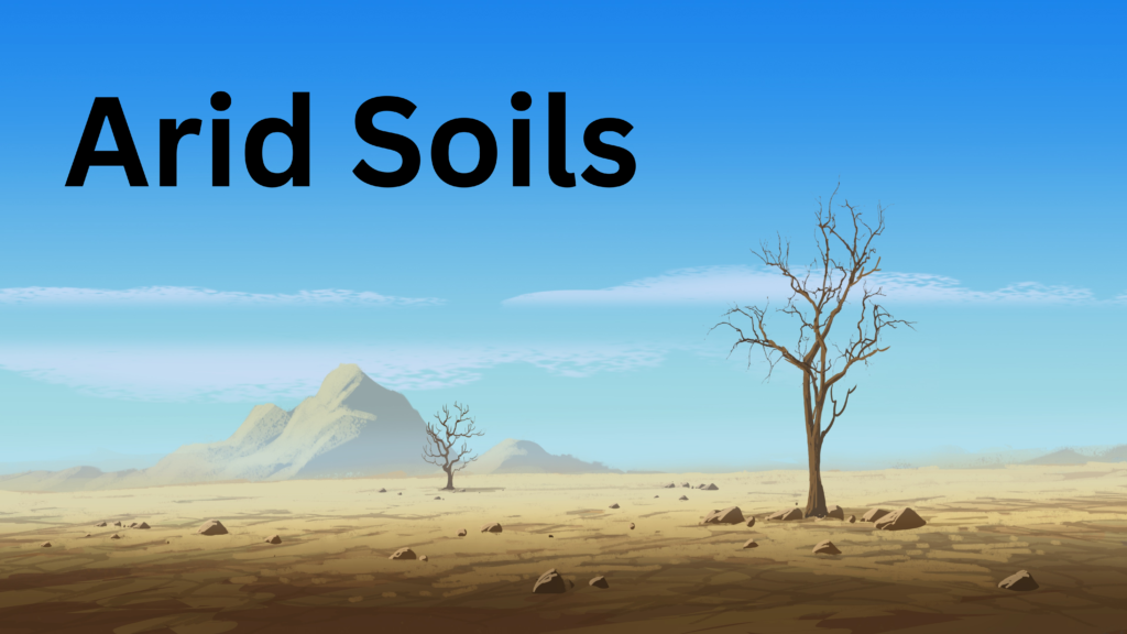
- Arid soils are typically sandy and saline, with colors ranging from red to brown.
- In certain areas, common salt is obtained through the evaporation of water, which contains high salt content due to the dry climate and lack of humus and moisture in the soil. This process is expedited by high temperatures.
- Kankar, which is a layer of soil with high calcium content, occupies the lower horizons of the soil. This layer formation at the bottom restricts the infiltration of water.
- With proper irrigation, previously unusable soils in western Rajasthan become cultivable
Forest Soils

- The soils referred to are found in hilly and mountainous regions where there is enough rainfall and forests.
- Soil texture varies depending on the mountain environment where it is formed.
- Soils in valley sides are loamy and silty, while those in upper slopes are coarse-grained. In snow-covered areas of the Himalayas, these soils experience denudation, are acidic, and have a low humus content.
- Fertile soils are found in valley bottoms, especially on river terraces and alluvial fans.
Soil Erosion and Soil Conservation
- Soil erosion is the denudation of soil cover and its subsequent washing down. It occurs simultaneously with soil formation, and typically there is a balance between the two processes.
- Human activities like deforestation, over-grazing, construction, and mining, as well as natural forces like wind, glacier, and water, can lead to soil erosion. Running water can cut through clayey soils and make deep channels called gullies, rendering the land unfit for cultivation and creating bad land. In the Chambal basin, these lands are called ravines.
- Soil erosion can occur through sheet erosion, where water flows as a sheet over large areas down a slope and washes away topsoil, or wind erosion, where loose soil is blown off flat or sloping land. Defective farming methods, such as ploughing up and down the slope, can also create channels for quick water flow, leading to soil erosion.
- Contour ploughing decelerates water flow down slopes, while terrace cultivation restricts erosion.
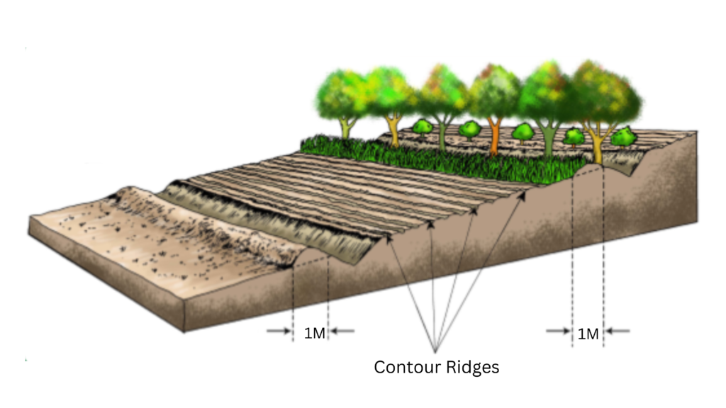
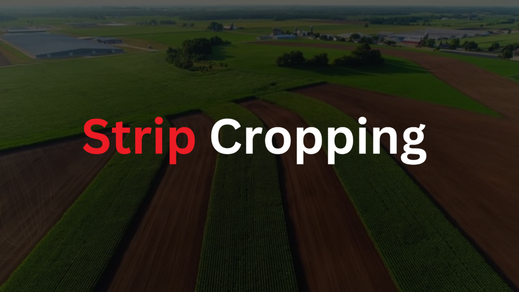
- Strip cropping is a farming method used in the Western and central Himalayas to protect crops from the force of the wind. Large fields are divided into strips, with grass left to grow between the crops. Planting lines of trees to create shelter is another effective method.
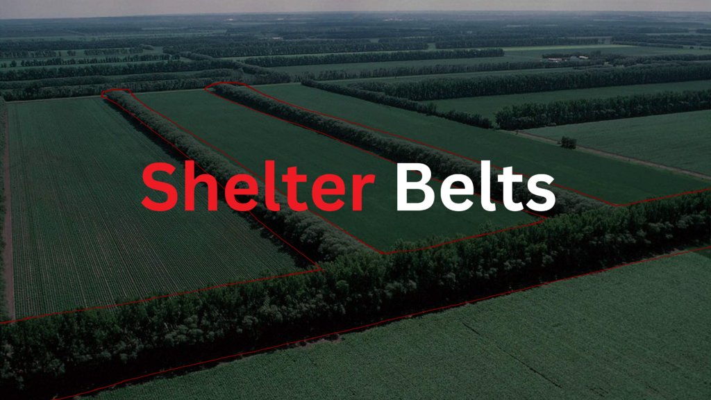
- Shelter belts, which are rows of trees, have contributed significantly to stabilizing sand dunes and the desert in western India.
Download PDF Notes
Downloa MindMap
NCERT Solutions
Exercise Page No 12
1. Multiple choice questions.
(i) Which one of the following types of resource is iron ore?
(a) Renewable
(b) Biotic
(c) Flow
(d) Non-renewable
Answer: Non-renewable
(ii) Under which of the following type of resources can tidal energy not be put?
(a) Replenishable
(b) Human-made
(c) Abiotic
(d) Non-recyclable
Answer: Replenishable
(iii) Which one of the following is the main cause of land degradation in Punjab?
(a) Intensive cultivation
(b) Deforestation
(c) Over-irrigation
(d) Overgrazing
Answer: Over-irrigation
(iv) In which one of the following states is terrace cultivation practised?
(a) Punjab
(b) Plains of Uttar Pradesh
(c) Haryana
(d) Uttarakhand
Answer: Uttarakhand
(v) In which of the following states is black soil predominantly found?
(a) Jammu and Kashmir
(b) Maharashtra
(c) Rajasthan
(d) Jharkhand
Answer: Maharashtra
2. Answer the following questions in about 30 words.
(i) Name three states having black soil and the crop which is mainly grown in it.
Answer:
3 states are
- Maharashtra
- Gujarat
- Madhya Pradesh
The crop grown is cotton.
(ii) What type of soil is found in the river deltas of the eastern coast? Give three main features of this type of soil.
Answer:
The type of soil found in river deltas is Alluvial Soil.
- It is excellent for the cultivation of crops since it is extremely fertile.
- It is made up of different ratios of sand, silt, and clay.
- For the cultivation of paddy and sugarcane, alluvial soil has a good amount of potash, lime, and phosphoric acid.
(iii) What steps can be taken to control soil erosion in hilly areas?
Answer:
The main techniques that can be used are given below.
- Contour ploughing
- Terrace farming
- Between the crops, strips of grass are let to grow. Strip cropping is the term for this technique.
(iv) What are the biotic and abiotic resources? Give some examples.
Answer:
Biotic resource:
- These are materials derived from the biosphere.
- These resources have life
- Examples are plants, animals, fish, human beings, livestock etc.
Abiotic resource:
- These resources are made of nonliving.
- Water, minerals, metals, wind, solar energy, etc. are examples.
3. Answer the following questions in about 120 words.
(i) Explain the land use pattern in India and why has the land under forest not increased much since 1960-61.
Answer:
Physical elements such as topography, climate, and soil types influence land use, as can human ones such as population density, technological competence, culture, traditions, and so on. The layout of the net sown area varies substantially between states. It accounts for more than 80% of the total area of Punjab and Haryana and less than 10% in Arunachal Pradesh, Mizoram, Manipur, and the Andaman & Nicobar Islands. The country’s forest area is significantly less than the intended 33% of geographical area, as indicated in the National Forest Policy (1952). It was regarded as critical to the preservation of the ecological equilibrium. A wasteland is a section of land that has been abandoned.
(ii) How has technical and economic development led to more consumption of resources?
Answer:
There are various reasons for this.
- Large-scale production resulted in resource overuse.
- Resource extraction increased as technology advanced.
- Better medical and health resources resulted in massive resource usage.
ThankYou – Keep Learning

